From Mercator to Google Maps at the Renovated MAP Mercator Museum
Following extensive renovation work, the Mercator Museum in Sint-Niklaas takes us on a journey through the history of cartography. Its central theme? The idea that maps are valuable yet double-edged tools for creating order in a changing world.
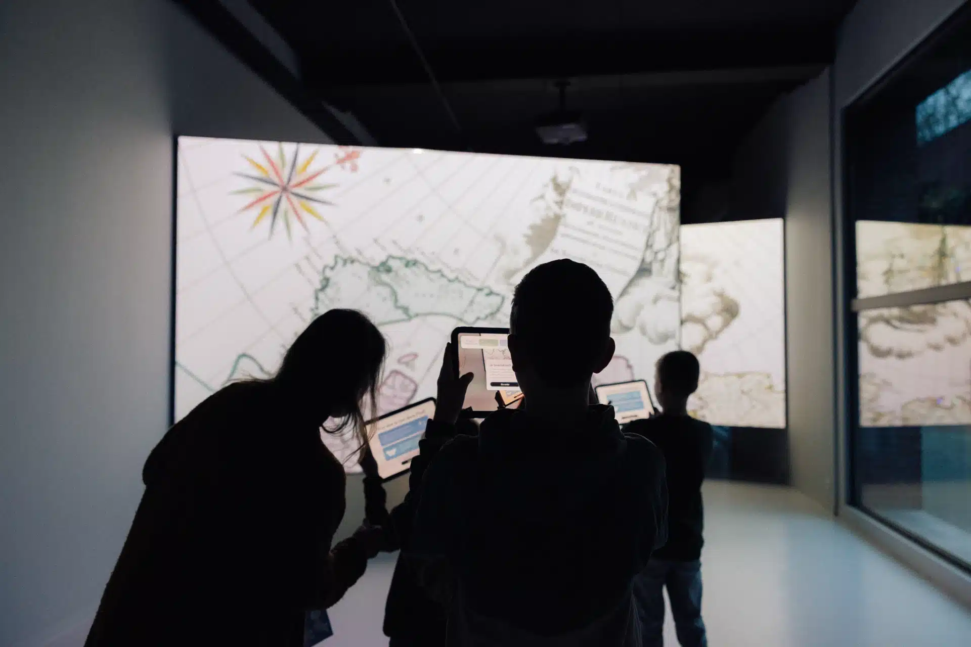
The journey starts before you have even seen a display case. Inside the lobby of the revamped MAP Mercator Museum in Sint-Niklaas, which reopened late last year following extensive renovations, maps can be seen gliding across two gigantic screens. They show cartographic details: moving coastlines, roads that seem to come to life, place names that disappear as fast as they appear. The accompanying music lends the whole thing the aura of a voyage of discovery, a trip through time and space.
The entrance leaves no doubt about the museum’s new direction. The Mercator Museum boasts an extensive map collection, but rather than simply display them behind glass, it incorporates these historical artefacts into a broader experience – ‘experience’ being a buzzword in today’s museum landscape. Projections, audio fragments and interactive elements are meant to draw the visitor into the story.
© MAP Mercator Sint-Niklaas
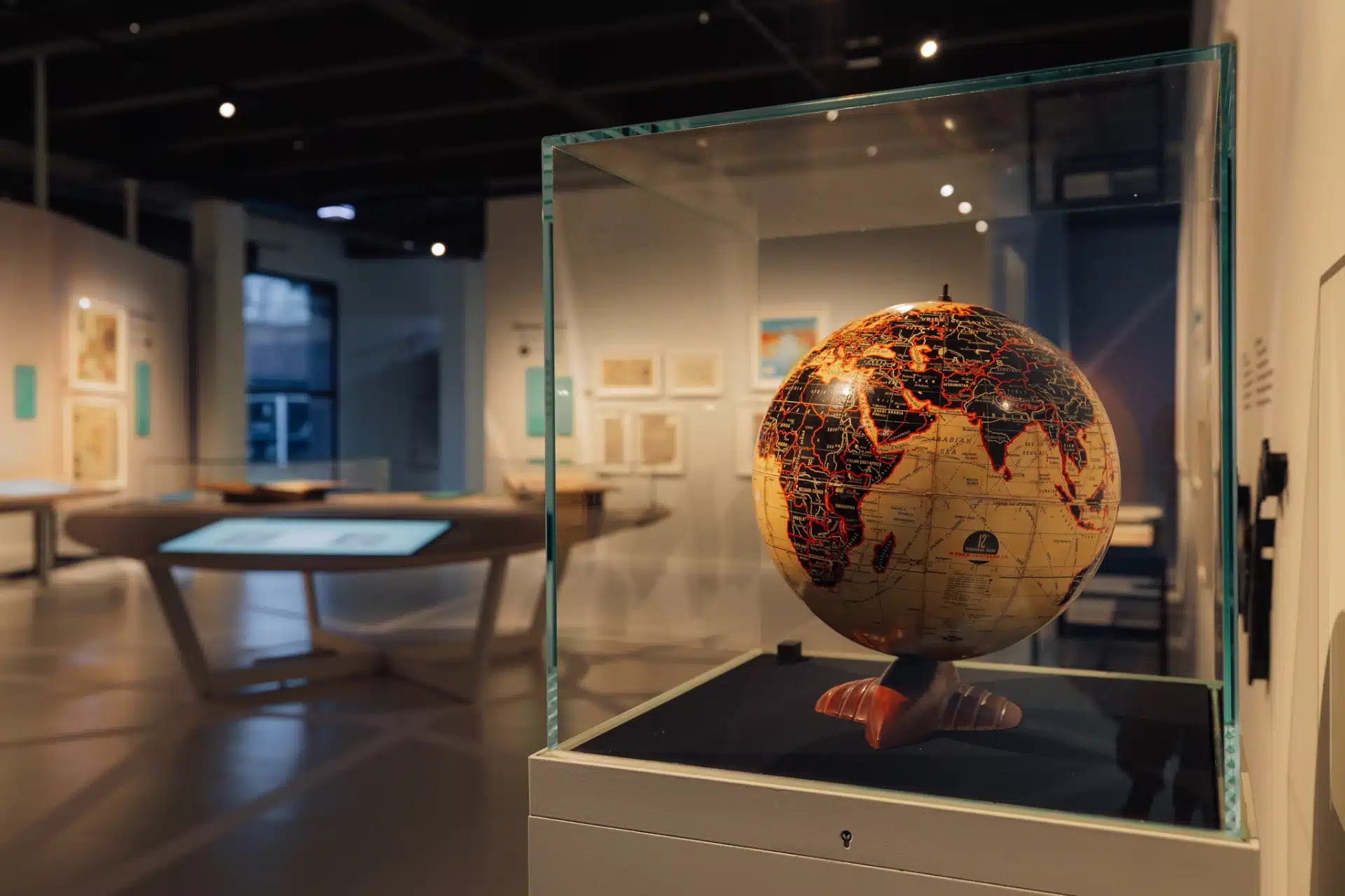
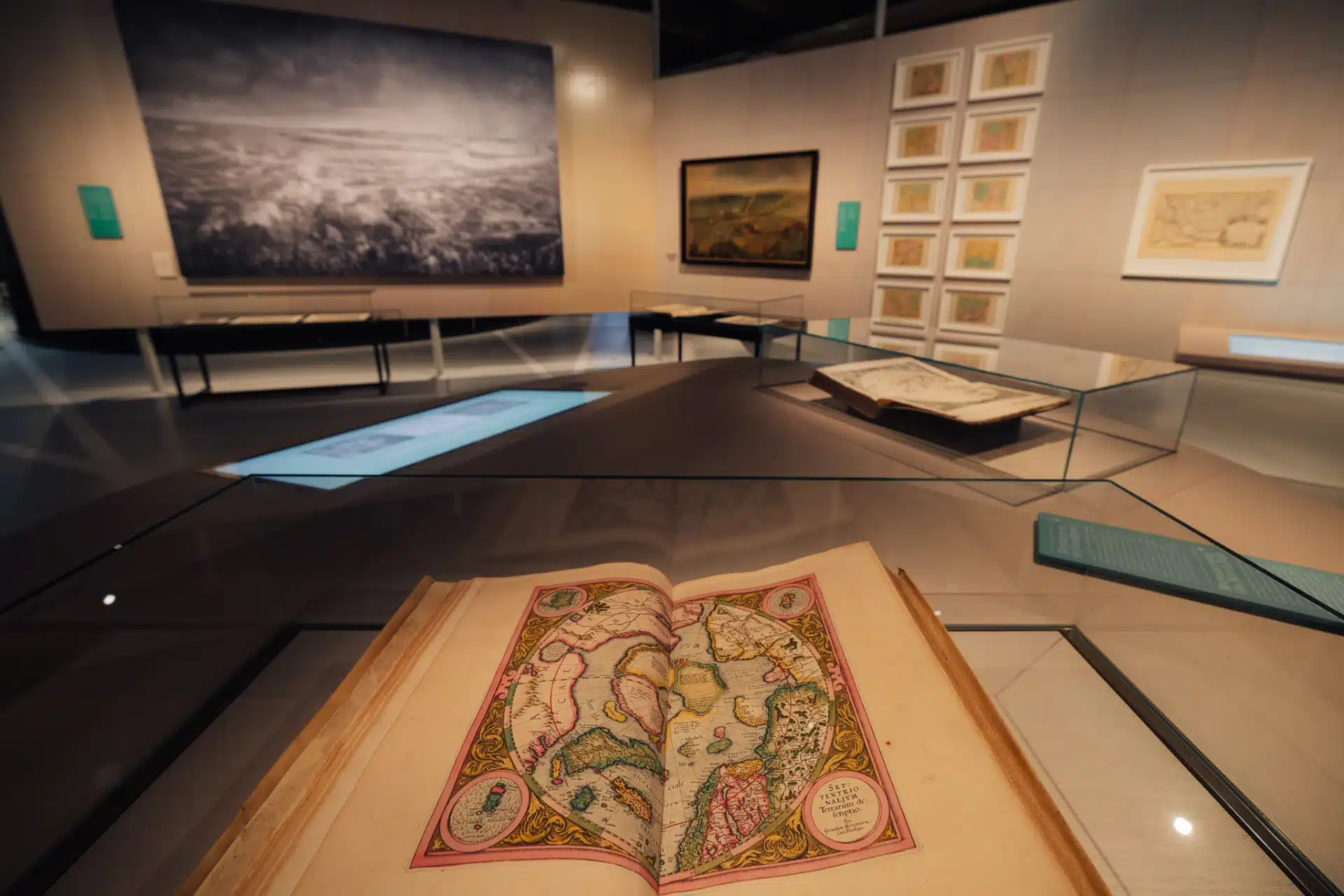
The route through the museum is not a chronological one, but something closer to a series of stages. Visitors move around a landscape of instruments, globes, archival material as well as maps behind glass: documents that shed light on their particular moment in cartographic history.
Historical maps and atlases are shown alongside contemporary navigation systems such as Google Maps, bringing together some five centuries of mapping practice, sometimes at a single glance. But the exact relationship between old and new is not always explored in sufficient depth – for example, there is not much attention to the differences between contemporary GIS systems and the technical logic behind a Mercator projection. Nonetheless, you come away with a pretty good insight into how the world is mapped, how these practices are constantly changing and how new tools build on older systems.
This new presentation required some practical modifications. Historical maps are delicate objects: paper, pigment and ink react strongly to light and humidity, and they must be kept at stable temperatures. Thanks to the renovations, these climate conditions have vastly improved.
While the work was carried out, the museum staff also delved into the museum archives. With the map collection far too extensive to display in a single exhibition, the museum decided to digitise it in its entirety – not with the aim of leaving the original items for what they are, but to make the material more accessible. Digital screens allow visitors to flick through maps that would otherwise remain hidden in depots.
© MAP Mercator Sint-Niklaas
It is one way in which the museum is trying to position itself as a place for learning and exchange – for (international) researchers, cartographers and the general public. Young visitors are also catered for: with educational quests and special learning materials for schools. The MAP Mercator is one of the few institutions in Flanders that specialises in cartography, thereby transcending the local and situating itself within a broader, European heritage.
Fantastical sea creatures
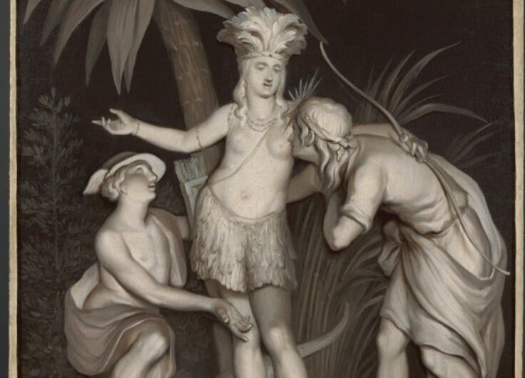
The museum is doing a good job of highlighting the ambiguity of maps. Much as they are valuable knowledge tools, they are also products of their time – and instruments of power. Right at the start of the route, you are confronted with Belgium’s colonial past. The first display case contains the map Illustration Congolaise, with the subtitle Le Congo Belge, pays d’avenir des jeunes Belges, or The Belgian Congo, land of opportunity for young Belgians. It was an example of propaganda-driven imagery around colonisation and intended to whip up enthusiasm among the Belgian public for the colonial enterprise. Cartography cannot be seen in isolation from political and cultural contexts.
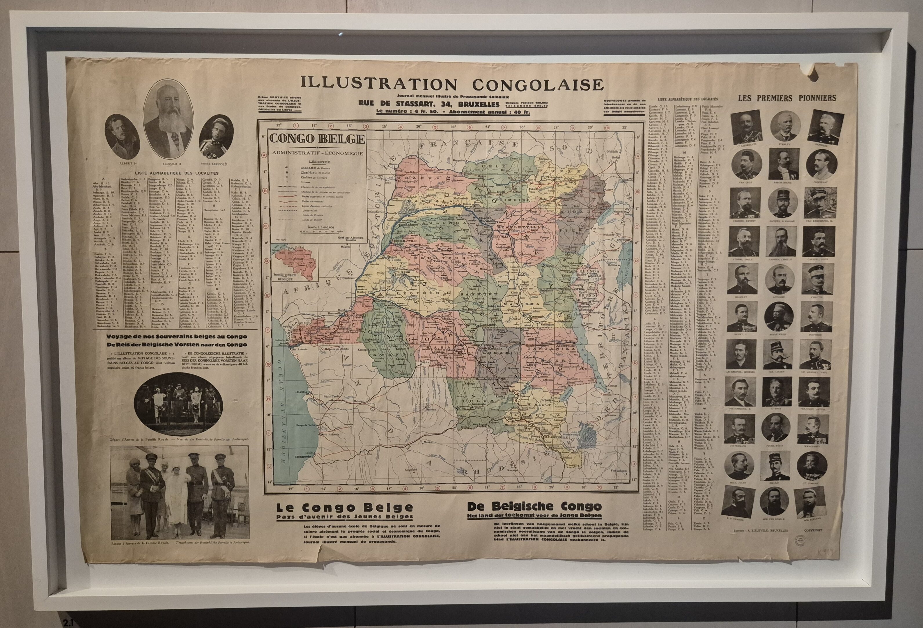 The Belgian monarchs and pioneers like Henry Morton Stanley, placed in the margins of the Congo map, were meant to evoke feelings of pride, control, and order in the (Belgian) viewer
© Sachka Vincent / MAP Mercator Sint-Niklaas
Another message that the museum conveys is this: maps are selections, showing certain elements and omitting others. In the sixteenth century, large parts of the world were all but unknown to western cartographers. They had to fill in these unfamiliar territories themselves, which explains the presence on some maps of sea creatures or hypothetical landscapes – elements that would be considered fantasy today, but that also effectively show how much these historical objects are products of their time.
Throughout all this, the exhibition encourages visitors to actively look and reflect. All along the route, you come across questions or invitations to formulate opinions about this or that map. You are even allowed to touch some maps to feel the topographic features, which in turn can raise further questions – to which researchers may not have the full answers yet.
Hot air balloon
About halfway, attention turns to the figure whose name the museum has borne since 1962: Gerard Mercator (Rupelmonde, 1512-1594). His story is told in an immersive installation in the form of a half-globe. Various screens simultaneously show images and fragments that present us with both his life history and the circles he moved in.
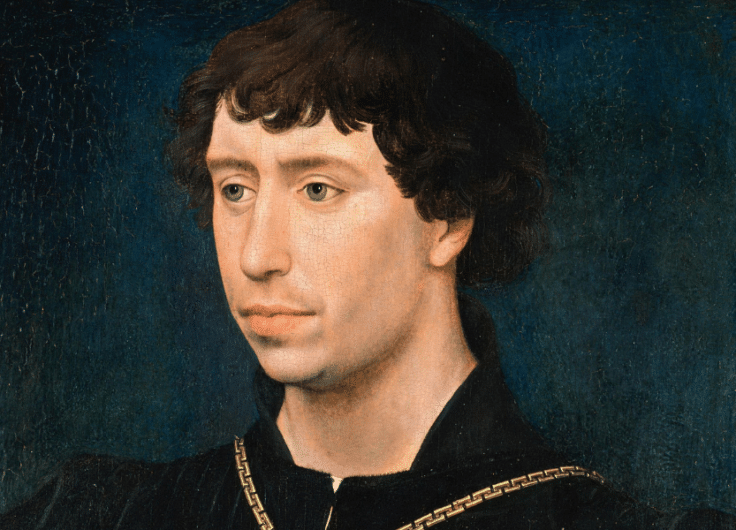
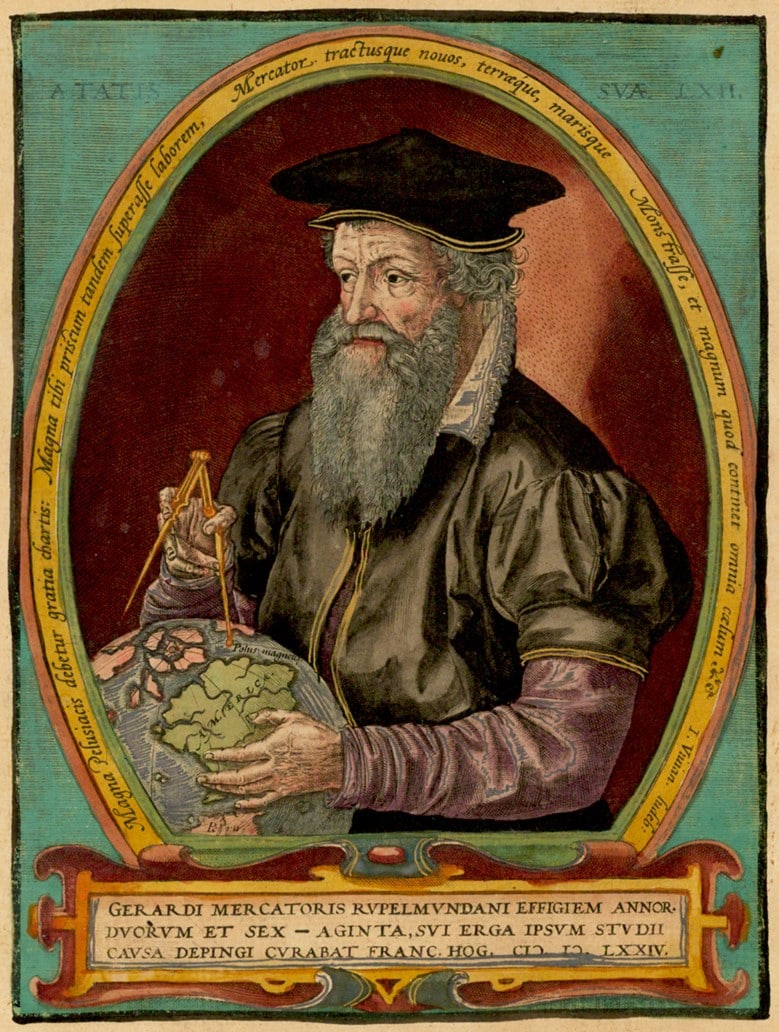 Frans Hogenberg, Gerard Mercator, 1574
© Public Domain
This set-up explains why the museum has chosen to put Mercator centre stage. Mercator is one of the most influential cartographers ever and a key figure in a broader tradition of knowledge production. These days he is primarily known for his Mercator projection: he projected the earth’s surface onto a cylinder and then unrolled this projection into a flat plane. This resulted in a map on which all the meridians are perpendicular to the parallels. It made navigating at sea much simpler.
But the Mercator Museum makes it clear that his reputation in the sixteenth century rested on a much broader foundation. In his own time, he was appreciated mainly for his celestial and terrestrial globes: modern that reflected their maker’s immense technical skill. They found their way into the cabinets of scholars, and to merchants and royal courts. Such was the demand that it could take up to eight years for an order to be delivered. By bringing these objects and their stories to the fore, the museum portrays Mercator not just as a theorist but as an artisan and entrepreneur as well.
© MAP Mercator Sint-Niklaas
At the end of the route, visitors can step inside the basket of a hot air balloon for an audiovisual journey through time and space. On a projection screen that spans nearly 180 degrees, a panoramic image unfolds and slowly glides across the landscape. From above, familiar places in the Waasland region come into view, after which the eye is drawn further and further.
It is a moment when all the information from the exhibition can sink in. The experience is symbolic of the history of cartography itself: what were maps other than attempts to distance oneself and view the world from above?

You might also like

Leave a Reply
You must be logged in to post a comment.